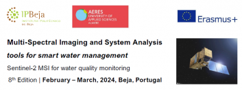
Organized in international teams (the working language is English), the students will apply a system based approach to define an early warning system for harmful algae blooms, to identify temporal patterns in the values of the quality parameters, and to search for its causes. The programme is organized in a project-based learning methodology, which includes problem solving, data search, retrieve and visualization, weekly presentations, and field trips to hot spots of the Alqueva Lake, where students will be able to use a hyper-spectral camera to acquire imagens in situ, and learn how to post-process them.
During the 5 weeks several researches from other universities will present lectures on related topics such as remote sensing, environmental impact studies, system analysis, and ecology. A visit to EDIA, the company responsible for the management of the Alqueva Lake, and a boat trip in the lake, will allow students to get an overview of the Alqueva system, its magnitude, and importance for the region.
By the end of the programme each team will have to combine the knowledge retrieved from the remote sensing tools with data on ecology and water quality to define and present a plan/measure to improve the water quality. The programme requires full-time dedication, and after successfully completed it will award 8 ECTS.
Student’s profile: Environmental studies, Eco-Engineering, Ecology, Water management, Water technology and similar Preferably (almost) finished their Bachelor or attending a masters course. Knowledge of satellite images processing is not necessary. All the necessary competences will be acquired during the programme.
The BIP is for... Students (SMS+B) BIP Participant
Field Of Study: 05 Natural Sciences, Mathematics and Statistics, 06 Information and Communication Technologies, 07 Engineering, Manufacturing and Construction
Start date: 12-Feb-24
Application deadline: 30-Nov-23
Coordinator: nuno.pereira@ipbeja.pt
Apply for selection at UACEG first: here
Източник: Instituto Politécnico de Beja

